About Me
My name is Rachel, I live in California, I'm 40, married for 15 years to Sean and have two dogs. My hobbies are my dogs Leo & Ferny, hiking, exploring, enjoying life.


Friends
Khiori
Nedra
Rob Follett


April 2010
Sun Mon Tue Wed Thu Fri Sat
        1 2 3
4 5 6 7 8 9 10
11 12 13 14 15 16 17
18 19 20 21 22 23 24
25 26 27 28 29 30  


Categories


Archives
April 2010
May 2008
March 2008
February 2008
December 2007
October 2007
August 2007
July 2007
June 2007
April 2007
March 2007
February 2007
January 2007
December 2006
October 2006
August 2006
July 2006
June 2006
May 2006
April 2006
March 2006
February 2006
January 2006
November 2005
October 2005
September 2005
August 2005
July 2005
June 2005
May 2005
April 2005
March 2005
February 2005
January 2005
December 2004
November 2004
October 2004
September 2004


Photos
Mojave National Preserve
JTNP - Geology Tour
Children's Forest
Calico Ghosttown
Holcomb Valley
Photo Page 1
Photo Page 2


Currently Reading
These Canyons are Full of Ghosts ~ Emmett C. Harder
Divine Secrets of the Ya-Ya Sisterhood ~ Rebecca Wells
The Field ~ Lynne McTaggart
Unfinished Tales ~ J.R.R. Tolkien
Zen and the Art of Motorcycle Maintenance ~Robert M. Pirsig

Finished:
The Re-Enchantment of Everyday Life ~ Thomas Moore, April 29, 2005
Nine Princes in Amber ~ Roger Zelazny, April 18, 2005
Battlefield Earth ~ L. Ron Hubbard, March 31, 2005
Quilter's Apprentice ~ Jennifer Chiaverini, March 21, 2005
Contact ~ Carl Sagan, March 19, 2005
Eye of the World ~ Robert Jordan, March 14, 2005


Contact


Credits:
Design by:
Carla's Graphic Designs
Photo © by: StockStash
Subscribe to this blog's feed
[What is this?]
Powered by: Movable Type 3.2
Hosting by: SRO Hosting


Home   Canine Epilepsy   Site Map   Contact   Archives   Forums


Khiori's Solitude

"Climb the mountains and get their good tidings; Nature's peace will flow into you as sunshine into flowers..."
~John Muir

If you are looking for the Canine Epilepsy page related to Khiori, please click here


Main

August 31, 2006

Joshua Tree

Well, until I get a chance to add this link to the side bar - here it is Joshua Tree blog list I'm putting this up because I notice more people this time of year do searches online for info on Joshua Tree. With the weather cooling, it's a good time to start thinking about a trip!

December 17, 2004

Joshua Tree NP - Conclusion & Summary

I had never really been interested in the desert. It made me think of heat, spiders, rattlesnakes, and that dry and dusty feeling your hands get. But Joshua Tree NP really changed my mind. It was incredible. I can't wait to go back again. I would love to spend a month exploring it!

Here is a listing of the entries for JTNP in order:


Joshua Tree NP

Joshua Tree NP - The Bajada

Joshua Tree NP - The Ocotillo Patch

Joshua Tree NP - The Desert ... Deserted?

Joshua Tree NP - Heading to the Cactus Garden

Joshua Tree NP - The Cholla Cactus Garden

Joshua Tree NP – Transition Zone

Joshua Tree NP - Split Rock Picnic and Skull Rock Trail

Joshua Tree NP - Key's View

Joshua Tree NP - Bill Keys

Joshua Tree NP - Day Two, Barker Dam

Joshua Tree NP - Day Two, Petroglyphs and Damage

Joshua Tree NP - Day Two, Geology Tour

Joshua Tree NP - Day Two, Going Home

December 16, 2004

Joshua Tree NP - Day Two, Going Home

The day finally came to a close. We left the park via the West Station, going over the mountain and to the north road from home.

On the way out we were treated to a view of this home:
Painted House

Our drive was a long one. But we were given a wonderful sunset to watch. The picture doesn't do it justice. There was no way to capture the incredible colors. You might recognize this from the icon though. They are the same pictures:
Sunset

December 15, 2004

Joshua Tree NP - Day Two, Geology Tour

I finished it!! The Geology Tour is finally done. Please take a look. I hope you enjoy it as much as I did making it. And even moreso, I hope it inspires others to go on it.

December 14, 2004

Joshua Tree NP - Day Two, Petroglyphs and Damage

Right along the Barker Dam trail is a cave full of petroglyphs. Petroglyphs are carvings made in the patina of the rocks/boulders found in the area. Unfortunately, someone didn't realize this and painted the carvings - in essense destroying them.

We stood and took a bunch of pictures and sadly commented on the boldness of someone painting the glyphs. Just about then a couple came up and the man started climbing all over the cave. It just seemed to add insult to injury. :\ Here is a page of the pictures and some comments.

We walked a bit farther and started to lose our trail. It branched in several different ways. I waited in the shade of a boulder while Sean scouted out the trail. It was a beautifully sheltered spot. The wind came through and made lovely sounds through this tree.

Trail tree

We found our way back to the car. It took a bit of walking in a wash. And we got to see a couple jack rabbits.

From there, we took the Queen Valley road (which was fairly uneventful) and crossed the road to the Geology Tour.

November 06, 2004

Joshua Tree NP - Day Two, Barker Dam

We decided to return to Joshua Tree NP the following day. Got up early, once again filled our mini cooler with goodies, grabbed camera and such and headed out the door.

Instead of approaching the park from the south like the day before, we decided to approach from the north side. It was to be a shorter drive but more interesting. No freeways, just highways. And the biggest part was just getting off our mountain.

We took SR 173. The only SR in California that is not paved. Nor really maintained. Dirt, harrowing, one car wide for two way passage. YIKES. Also, it's prone to slides.
SR 173

We passed a few others and no one was pushed off the edge :) We were rewarded with a nice view at the end. Whew.
Victor Valley

Our first stop once in the park was Barker Dam. We had driven past the trailhead the day before. Today we would walk it. According to the signs it was a mile walk. We somehow ended up walking a good three miles, missing a turn in the trail and ending up on a new one entirely lol.

Barker Dam was created by the ranchers in the area to catch rainfall for their livestock. I was surprised to see some water still in it from the last rainfall - months before. It was such a pretty place that I'm not surprised there's a nature to it. We also saw a bit of the Desert Queen Ranch although we didn't know it until hours and hours later.

Barker Dam "Pond" for wildlife watering now.
Barker Dam Pond

Barker Dam wall
Barker Dam wall

Desert Queen Ranch Watering trough
Watering Trough

Closeup of the trough showing year it was made
Date on the trough

October 28, 2004

Joshua Tree NP - Bill Keys

I found some links about Bill Keys and the Desert Queen ranch. They are very interesting stories about this pioneering family. Can you imagine? People happily living in the desert like that - without all the air conditioning people think we need now? ;)

This link is a narrative "autobiography" of Bill Keys. Key's View by Michael Dare.

Key's to the Past talks about the ranch and family.

October 26, 2004

Joshua Tree NP - Key's View

The shadows were growing long so we continued our way. The next stop was Key's View, named after Bill Keys who homesteaded in the area in 1917 until his death in 1969.

I was going to type up a big thing about Bill Keys and his family. But I think I might just do that for another entry. It's fairly interesting though. It really gives me pause to think of the people who adapted to the land or at least were able to sustain / thrive in such a harsh environment.

We went to Keys View and got some really nice views.
Keys View

I'm sure the better time to visit would be early morning before all the dust and haze rises. But even so we were afforded some interesting views of San Andreas fault, Salton Sea, Mexico, and so on. There was a short trail with plaques that talked about the air quality and other things. But there was a rather large group of tourists who didn't look as though they were wanting company. So we took some pictures and moved on.
Keys View

We were just about done with our day. Sun was setting and it was a long 100 mile drive home. BUT THERE WAS SO MUCH MORE TO DO! We couldn't just leave yet.

We stopped on the side of the road to watch a gorgeous sunset and have a very late picnic lunch of sandwiches, sodas, cheese and grapes.
Last stop before leaving

We had such a nice time sitting and talking quietly with each other about the day.
Last stop before leaving


I looked at the map and wished we had done the Geology Trail and Queen Valley Road. We decided to come back the next day :)

On our way home, we were treated to an amazing sunset and watched other people make their way home. It was dark by the time we reached the mountain. We returned via the "back side" on highway 38. It was probably 8pm by the time we got home. Exhausted but stunned with the beauty of the day... plus the knowing that we would be back the next :)

October 21, 2004

Joshua Tree NP - Split Rock Picnic and Skull Rock Trail

Entrance sign to Joshua Tree National ParkWe left the park to get some gas (had to show our pay stub leaving and reentering the park). Then zoomed back in. It was getting late at this point and we knew our day time exploring would come to an end soon. We hadn't eaten yet (not even breakfast). It was around 2:30pm.

Our first stop was at a picnic ground called "Split Rock". Right across the road was another picnic area called "Live Oak". We just randomly picked a place and drove in. It was a bit crowded with cars but no one in sight. We saw picnic tables and a nice CLEAN outhouse. Then the trails.

Split Rock Picnic Area

There were trails that went just about everywhere. Again, we randomly picked one and started walking. I have to put here that I carried a "fanny pack" that held quite a bit of things like camera, first aid, sunscreen lotion and several bottles of water. It's pretty nifty!

We saw some folks rock climbing a vertical face. But for some reason, I got really hot and really aggravated. So we turned back to find shade and eat our lunch. Right under "Split Rock" is a cave that (by the looks of it) has been used for generations. You could probably have an entire tribe utilizing this cave as base camp.

Split Rock Cave


We were at a point where we weren't sure where to go next. We decided to check out Keys View. On the way we saw a spot called "Haunted Tunnels" or something so we just HAD to stop. So we did :) On the map it's called "Skull Rock" Well, we found neither a tunnel, a skull or anything remotely close to haunted. But we did find lots of .....

trails .....
Skull Rock Trail


lizards ...

Lizard

and me :)

Skull Rock Me

October 18, 2004

Joshua Tree NP – Transition Zone

We left the Cholla Cactus Garden and continued along Pinto Basin Road. It was as if we were in a completely new land when we came over a ridge and landed into the “Transition Zone”.

This area is the land that lies between the Colorado Desert and the Mojave Desert. We pulled off at a trailhead to look around and take pictures. This is the typical kind of landscape that was in this area.
Transition Zone

We were drawn to all the different rock formations and couldn’t really say why. In fact we commented on that several times. The next day we would really find out more about these rocks and get a very good look at why we were so drawn to them. In the meantime – pictures!

Erosion

Erosion

Erosion

Erosion

I really hesitated including this picture. But I was really happy. And I shrank it small enough to not be able to really make out what I look like :p
Me

October 15, 2004

Joshua Tree NP - The Cholla Cactus Garden

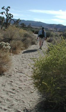
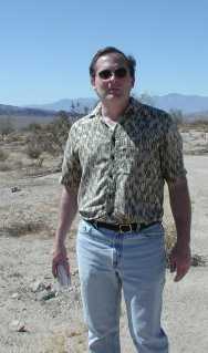
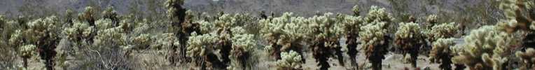
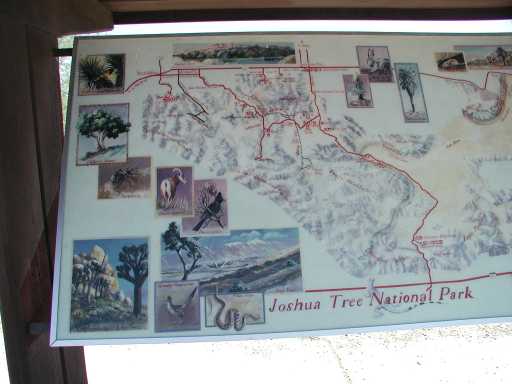
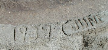
Cholla Cactus Garden at last! This nature trail had 16 stops with descriptions. And lucky for us, there was a trail guide pamphlet too :)

Cholla Cactus

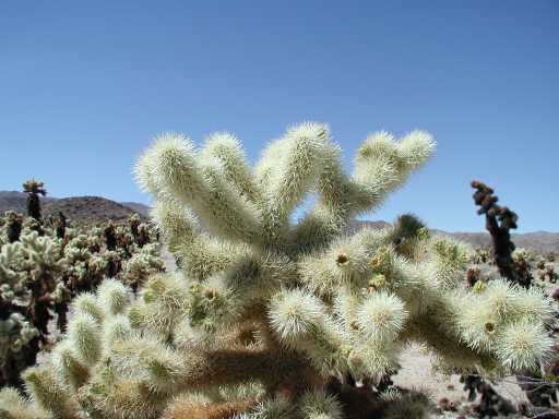
In this area, annual rainfall rarely exceeds 4". Summer temps are in the 115 F range. Yikes. Hot and dry. Cholla: Opuntia bigelovii

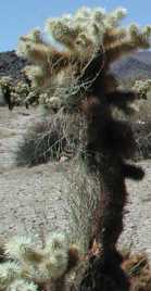
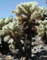
1. Cholla are pronounced "choy-ya" and are armed with barbs on the tips of every needle. We didn't get 'stuck' here - but a week later we had a slight run-in with it. It sticks! The plant is also called the Teddy Bear cactus but woe to whomever hugs this thing! =:o

2. This marker showed a ... nest? It talked of the 'desert wood rat'. We didn't see any. We did see the nest though.
Wood Rat nest
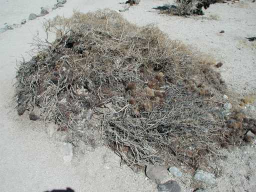
This was about 5 feet long and 3 feet across. And I'm guessing at least two feet tall. Of course, snakes often will eat the rats living in these nests. The thing that impressed me was the rat's ability to live among the cholla cactus. According to the pamphlet if a rat gets stuck with a needle "rather than struggle, the wood rat patiently turns and bites off the spines." I wonder what coyote do?

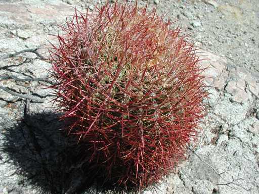
3. This marker showed an example of a Silver Cholla. I can't seem to find a picture of one in my files although I'm sure we took a photo of one. Oh well. It's common to the area. It's also called the "Opuntia echinocarpa."

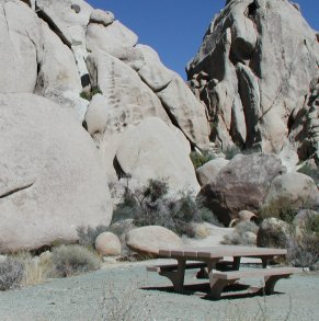
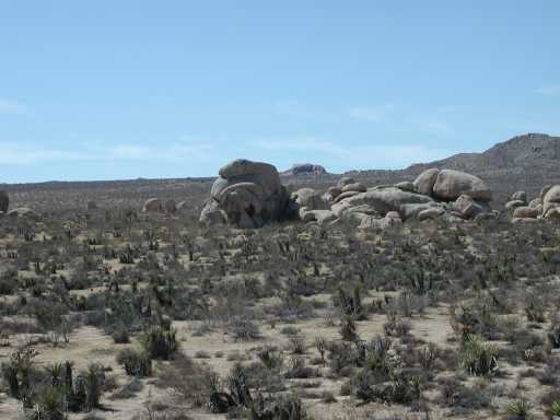
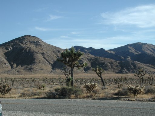
4. At one time this basin was a shallow lake. Time marches on and changes all things. The mountains (once tall) are now rubble. Sand and gravel fill the one time lake. It's now filled with cactus and a part of the Colorado desert.

5. Another cactus I don't seem to have a photo of. The Hedgehog cactus or Enchinocereus engelmannii.

6. The Climbing Milkweed is living on this cholla.
Climbing Milkweek

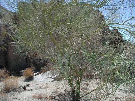
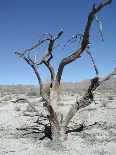
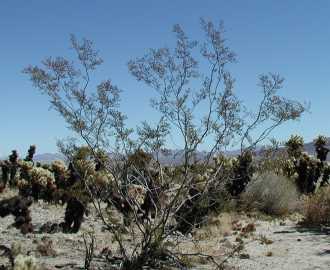
7. Creosote bush! This plant is very interesting for how it survives. It will create a soil change that prevents other plants from growing around it. Sometimes up to 20 feet. The roots are both deep and shallow to gather as much moisture as possible. There are three sets of leaves. Spring growth falls off during hot summer months. If a drought continues, the hardier/olive type leaves will fall off. And lastly, the brown, hard leaves will continue to function when the other two types of leaves fall off. How cool is all that?!
Creosote Bush

8. The cactus colony is able to grow so well here due to the water supply being "seasonally plentiful" and well-drained soil. At least that's what the pamphlet said ;)

9. There was a jojoba plant here. I almost missed it but did go back and take a photo of it. It didn't turn out well. But I would like to mention again the need for desert dwellers to assist in each other's survival. The ground squirrel will take the seeds and bury them for storage - but in effect "plants" the seeds. The plants produce either "male" or "female" flowers. The leaves will stand erect in sun (to reduce the amount of light received) and are covered with fine white "hairs" to reduce overheating and water evaporation.

10. The Cholla aren't burned. The dark brown is indication of the plant aging and dying from the bottom up.
Cholla growth

11. The next marker showed a cholla with bird's nests in them. The cactus wren will build their nests and raise their young in the cactus. We saw the hole in the cactus but no birds. People probably distrubed the birds at some point in the past and they've since stopped nesting here?

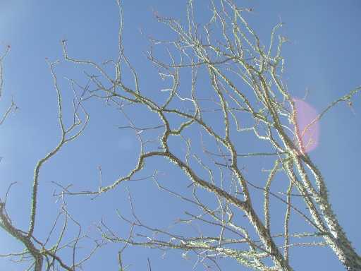
12. The Pencil Cholla!
Pencil Cholla
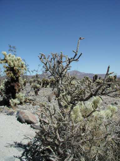
We saw some of these down at the Bajada. They were dried up and stick-ish looking. Then there were others nice and green and plump. Obviously those had some water and were storing it. Do not touch - they have those fine hairlike spines that are next to impossible to remove. OUCH.

13. This marker showed the roots of the cactus and how they are close to the surface. They are also cork-like in looks and function. No piccy. Sorry!

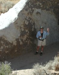
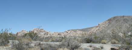
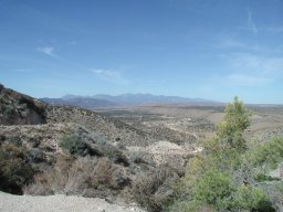
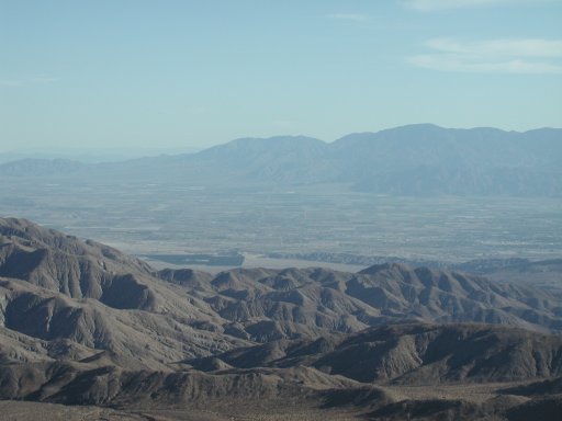
14. The Pinto Basin. I didn't appreciate this view as much as I would the next day. The view is of the Eagle Mountains (to the center and furthest away). It has deep canyons, palm oases, and pine forest. To the right are the Hexie Mountains. In the far distance is the Coxcomb Mountains. And to the left are the Pinto Mountains.
Pinto Basin

15. Believe it or not, the local peoples (the Cahuilla Indians) would eat the cholla. The buds were collected into baskets with sticks (I wonder if the cactus would "climb" their way out?). The buds were steamed for 12 hrs or more in pits lined with hot stones. The end result was both eaten new and stored for later use.

16. At this point we were hot, tired and ready to move. So I didn't get a photo :\ But the Desert Senna stood here at the very end. I honestly don't remember it. We were in that much of a hurry to move on.

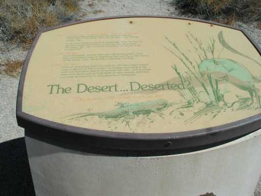
The pamphlet ends with this:
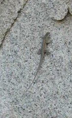
Along this trail you have seen how life can flouish in the desert. To live here requires special adaptations in the roots, leaves, and seeds of plants. The plants found here have developed modifications over a long period of time. Where you find plants you will always find animals, if you take the time to look. Perhaps you saw a side-blotched lizard dart across the path or a red-tailed hawk soaring overhead. Life abounds, and what seems to us to be the most hostile environment can be most hospitable to others.

I hope you enjoyed reading this as much as I did writing it - but mostly experiencing it!
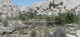
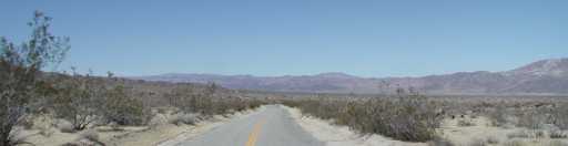
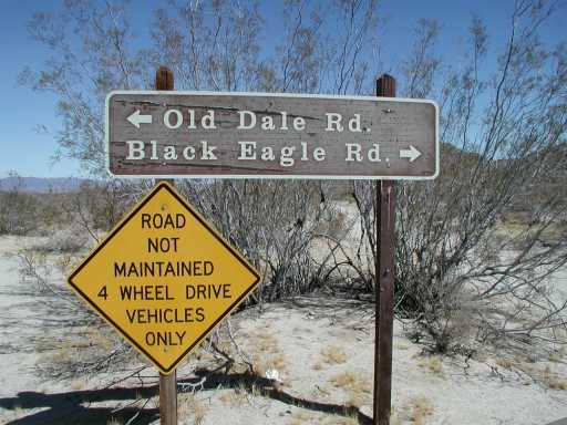
October 14, 2004

Joshua Tree NP - Heading to the Cactus Garden

We got back on the road and continued our way. The road we were on sits in a valley of sorts called "Pinto Basin". It's classified as the Colorado desert. We will eventually cross over to the Mojave desert.
Pinto Basin

We crossed a wash with a name. It made me laugh so we took a picture of the sign. I have no idea who named these things nor why they got the names they did.
Fried Liver Wash

And here's the hero of the day!!
Sean

We soon reached the Cactus Garden. It was incredible coming over a rise and seeing an ocean of cactus. There were signs that cautioned us not to stop. So we didn't - but waited until we got to the Garden itself. It had a full parking lot and many people were walking the short trail. One lady had an umbrella which I commented on how clever it was to stay cool. My legs were burning from the heat of the ground - almost like cooking. It was a strange sensation that I get from time to time in heat like that.
Cholla cactus view

October 13, 2004

Joshua Tree NP - The Desert ... Deserted?

Between the Bajada and the Visitor's Center is a small turn out with a path leading toward a wash and some rocky hills. You could easily miss it. I'm sure there were tons of these places along the road that we never saw. But we saw this one and stopped to see what we could see.

The desert to me seemed like a dead, dry place where the land hardly gives enough for the inhabitants to survive. How far from the truth!!

Walking this short trail we could see many plants living. Some seemed dead. Some in a state of readiness. They were all alive though.

We walked to the wash near some rocky hills. There were amazing looking plants. This cactus was just one of a dozen we saw.
Red Cactus

We turned a corner and saw this Palo Verde Tree. I see why it gets its name! It was so green!
Palo Verde Tree

The longer we were there, the longer we watched and listened - the more we realized how many things were calling this desert their home. Birds were everywhere. Lizards and bugs. The plants. All living here and hardly seen. It was awesome.

The deserted desert?
So the question begs an answer. Is the desert deserted? Hardly.

Joshua Tree NP - The Ocotillo Patch

I'm going to talk about two stops we made next. First was at the visitor's center to get our pass. It was $10.00 per car. We talked a little with the ranger there about our dogs and that it's too bad they couldn't go on the trails. She peered out to the parking lot to look at our car and we quickly let her know we didn't bring them but that they enjoy going places with us :)

Anyway, the ticket was good for seven days and the time we paid was 12:20pm. A little late in the day but still at least four hours to drive around. We were running low on gas so knew we'd have to drive north out of the park to Twentynine Palms to get some more. But in the meantime, we'd stop a few places along the way.

We first took a stop at a crossroads. It was Old Dale Road, Black Eagle Mine Road and the one we were on - Pinto Basin Road. The views were amazing. Sean wanted to take one of the side roads (sandy) but with only us it would be dangerous. So we took a photo and drove on.
Crossroads

Hmm, I'm forgetting one stop prior to this but I will get to that later on. It was at a place titled "The Desert . . . Deserted?" It was fascinating. I will definately write about it later.

We drove on to Ocotillo Patch. It was such a neat place. We stopped next to a wash (I don't remember the name now) and got out to take pictures. These ocotillo are really neat plants. They grow to be very tall. They have a beautiful green shade due to small leaves that grow all over it. And when in bloom it is covered in small red flowers that remind me of little firecrackers. This picture doesn't do justice to the plant.
Ocotillo

I was watching a group of Jeeps passing by and wishing we had 4x4 type friends :)
Me

October 06, 2004

Joshua Tree NP - The Bajada

Continuing the story of Joshua Tree National Park. The Bajada Nature Trail was our first stop.

I should mention here a couple things. The park has NO services. At least not many. There's no gas, no food and limited water. You can find water at Cottonwood Camp and Black Rock Camp. Also at the entrances there are water fountains. But don't expect to be driving along and get hungry/thirsty and think you'll find something right away. You won't.

Also, fees. $10.00 per car or $25.00 for annual pass. We finally got smart and bought (the following weekend) a Golden Eagle Passport which gets us in practically everywhere. There are camping fees - regardless of pass you have. They range in $5.00 to $10.00 per night depending on camp.

Ok, back to Bajada trail. :) It's a quarter mile loop on packed sand. At first I was just excited to finally be there. But after a little while I began to realize the fragilities of the desert. All these plants depending on one another. The soil, the plants, the bugs, the birds and lizards, the dead matter, the wash - it all is dependent on each other. While we saw a seemingly dead land - these all patiently wait for the conditions that send it all into a growing and blooming pattern. Furiously they grow and reproduce before conditions once again send them into a patient waiting.

Incidentally, it was about 100 degrees when we arrived. It lowered slightly (about 95) during the day - but overall about the same. It was pleasant though due to a nice breeze and your body adjusts well to the dryness. I used LOTS of sunscreen though.

We left to go on our way. We didn't get far. We stopped at another little walk in a wash which showed how alive the seemingly dead desert really is.

Couple pics :)

Joshua Tree NP map

food for the desert

October 05, 2004

Joshua Tree NP

I could probably create a month's worth of entries entirely based on Joshua Tree National Park. It was INCREDIBLE! From the moment we got there until we longingly left we were overcome in awe. I want to go back. Let's start at the beginning....

I was to start a new job the following Tuesday. (September 28, 2004) We had been out and about and thoroughly enjoying ourselves. The job that I was to take on would require all weekends. So we thought we would grab one last one at a place we hadn't been to before.

I thought of two places. The first and the one I leaned more toward was Providence Mountains in the Mojave Desert - north east of us. The other and closer was Joshua Tree. We had been to neither but decided on Joshua Tree due to the easier trip and shorter drive.

We packed a big lunch, loaded up full of water and headed out at the late hour of 10am. We arrived at about noon or just after. It was a really nice and interesting drive. The desert areas were fascinating. We first saw many wind mills - those wind farm kind. Then we passed a ton of Indian casinos. That sort of blew our minds.

We entered the park from the south at the Cottonwood entrance. Before even entering the park we were jaw dropped at the beauty. Unfortunately we didn't get any pictures of that part. But we soon had the opportunity to stop at a nature walk. It was called the "Bajada Nature Walk". I'll talk more about that tomorrow.

I just want to quickly highlight the day. We walked the Bajada. Then another short trail. We stopped at the Cottonwood station to pay our $10.00 fee. We drove through to the Cactus Garden, out to Twenty-nine Palms for gas, back in to Jumbo Rocks, Keys View, then out to home. It was about 5pm when we finally left. Knowing how much we missed we returned the following day to see Barker Dam, Queen Valley and the pinnacle of both days - the Geology Tour Road.

A teaser photo:
Cholla Cactus Garden


Another web site concerning the Mountain Communities of the San Bernardino mountains. Thank you for visiting :o)


Home   Canine Epilepsy   Site Map   Contact   Archives   Forums