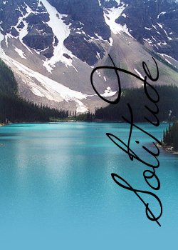
Khiori's Solitude
"Climb the mountains and get their good tidings; Nature's peace will flow into you as sunshine into flowers..."
~John Muir
If you are looking for the Canine Epilepsy page related to Khiori, please click here
Main
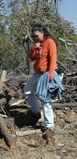
Omg. I'm so frustrated. I just want to go home!
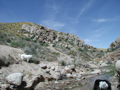
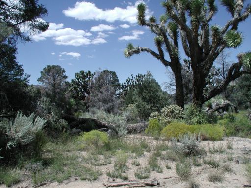
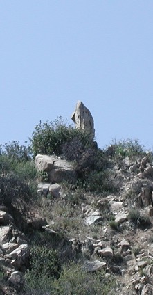
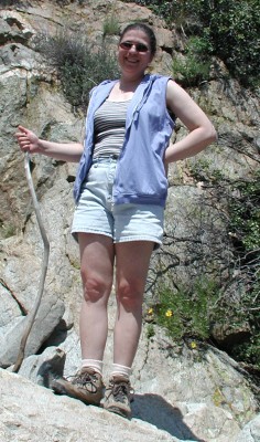
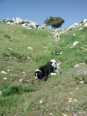
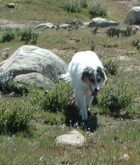
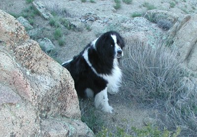
Juniper Flats area. Beautiful isn't it? I love those big rocks. Pretty soon it will be too hot and "snakey" out there. But right now, it calls...
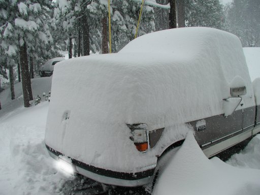
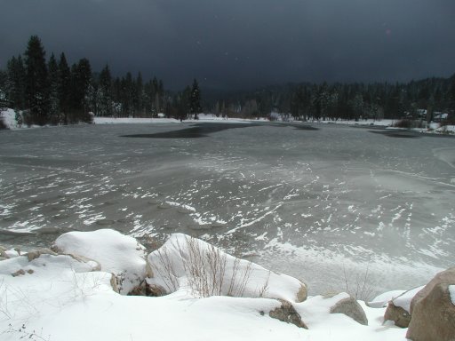
We finally got SNOW! 3 feet of it! Here are two pictures from Sunday.
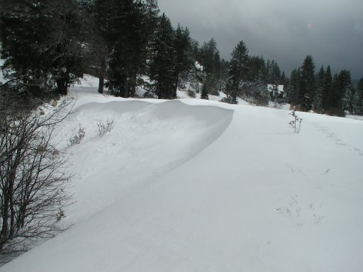
Drifting snow over the golf course dam
Little golf course lake
Today I had every intention of writing about a hike or some such exploration. I sure have enough things to talk about! I thought about the time we went hiking and I wanted to rediscover my barefooted Hawaiian roots - and almost walked on a rattlesnake. Or the time we took our friends up to Mill Peak in winter - and ended up trudging through two feet of snow, returning with soaked boots. Although that taught me to carry plastic grocery bags on all hikes. I mean, who would have guessed they make great moisture barriers.
Instead, I am going to write about today's adventure.
It's been about a year since I've driven. Strange, I know. Silly technicality with Social Security and subsequent loss of license with DMV. But I digress. I did eventually get my license back. It just took a while.
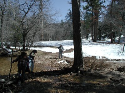
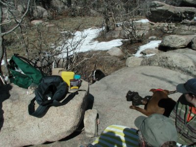
I thought I had better get some driving in after all this time and figured going off road would be just as good practice as anything. We loaded up the dogs, packed a picnic lunch and hit the road. 3N34, here we come!
It's unbelievable the weather we are having this year. Dry and warm. Lots of folks enjoying the nice weather. We found Off Highway Vehicle volunteers doing trail maintenance - fence repairs in particular as we passed them.
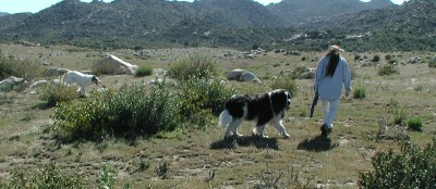
There were a few others taking advantage of the nice day. Some driving motorcycles, some on ATV's and a few others in 4 wheel vehicles like ourselves. We got to see a lady riding her horse with her two dogs in tow. (How cool is that!) One person was Geocaching. Another had gone out to collect firewood. All of us out there, enjoying the forest in his or her own way.
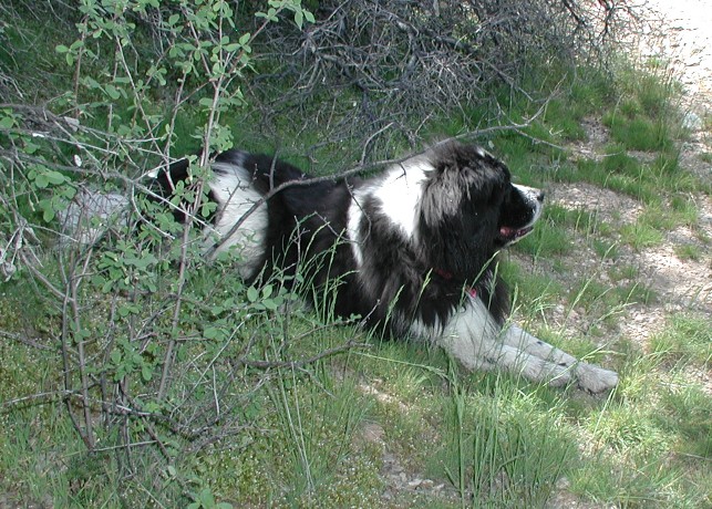
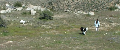
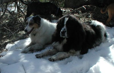
We explored the forest from the road. Drove 3N34 from the Pinnacles Staging Area toward Hook Creek. Left the forest road via Torrey (Pines?) Road. We reentered the forest from the vicinty of Yosemite area. Our dogs had a nice ride. The newfy just loves to ride. The collie would prefer to herd quail. Or lizards. He doesn't care which. He got to do neither. All in all - just being out and about in the forest is a blessing.
Maybe next week we'll actually hike.
Wow! What a wild month January turned out to be! Let's see...
Went camping in the Ord Mountains. I just love it there. And the dogs get a real kick out of being in the middle of nowhere full of rabbits and birds. Ok. Bird Dog Leo loves it. Solo just wants to make sure we all stay together and no one gets toooo far from the rest of the "pack" on the walks.
Later in the month : Motherboard and RAM fried. Hee hee. When I say "I don't know how to do this, maybe *you* should" well... listen. :D So yeah. My fault. But it didn't happen without a warning cry of "HOW DO I DO THIS??!!" eheheh.
Turned off Satellite TV again. This time it's not as painful ha. How come I have so much time to do things in the evenings now? Same number of hours. But more is getting done. hmmm....
Speaking of more time: I've been asked to write articles for our local magazine! I'm THRILLED!! So I have to get myself in gear. I'll be writing up stories on our local hikes. It should be a lot of fun. With this and the Forest Service Photography volunteer work - well. Someday I might "know" our forest. In the meantime, we're still poking and learning and discovering TONS of new things.
I think that brings me up to date. The last thing I need to mention: TOTE BAGS! Yes, they are finally here! I've been sewing away like a little magic Brownie in the sewing loft and getting some things done. Now they are ready for viewing. I'm so proud of them. My good friend, Coral (of Newfstitch.com) does the embroidery shown on the bags. She also has her own line of Newfoundland dog paraphanelia. Did I spell that right? Oh well, you get the idea. Just go look at her site. Got a drooler? She's got the bib for you!
For my work: I'll have another entry up in just a few minutes.... *zoom*
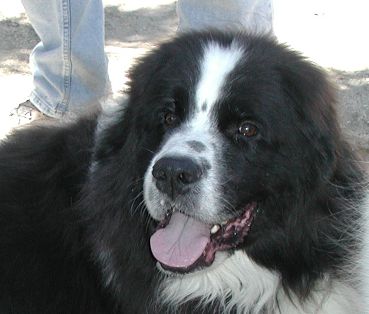
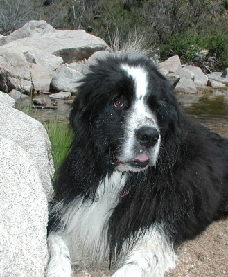
Solo and his injured eye:

The day the E-collar came off:

A few days later on a hike:
The view in the area we went for a hike:
The day we went to the Pinnacles we had no intention of climbing it! We started off at about 1:30pm and my intent was to locate the path, explore the bottom land a bit and take pictures of local plants.
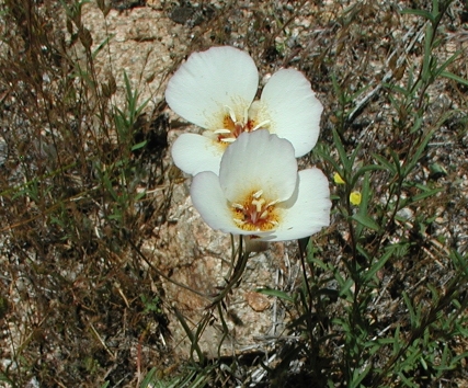
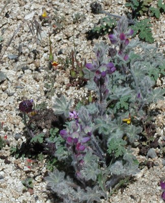
A big part of the walk was to take pictures of plants and later identify what they were. One of the first I found was the Sego Lily.
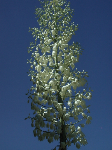
We climbed higher and I took pictures of the yucca in bloom. It smelled very nice.
It was around this point we realized we had come at least 1/2 way up the trail to the peak and figured we'd continue on a bit more. Still, I didn't think we would do the whole thing.
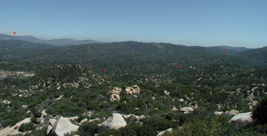
I thought I should put up a view shot here. A. is the trailhead near the Arrowhead Shooting Range. B. points out Highway 173 at the "bend" past Rock Camp. C. is approximately where our home is. We never really did figure out exactly where it was. And D. is San Gorgonio.
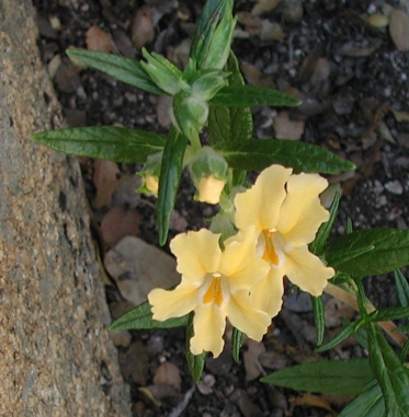
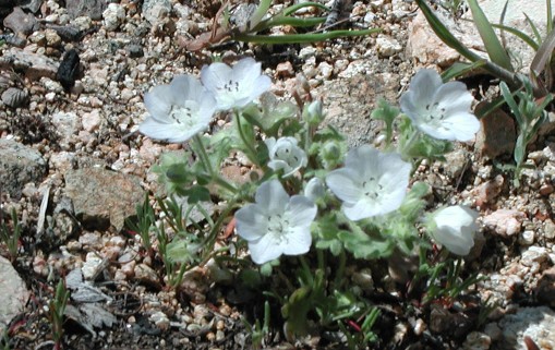
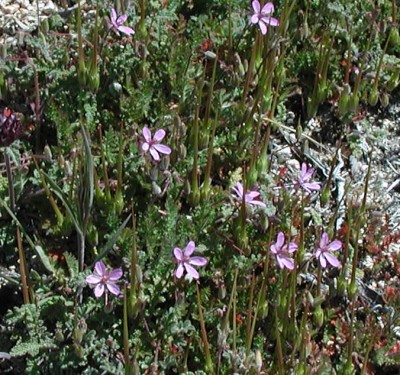
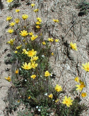
We continued and found these beautiful yellow flowers. I'm still trying to find out what they are. If you know, tell me please!
And we found another really pretty yucca flower stalk.

I sort of thought we had arrived at the peak. But it was just a first one. Beyond it was another small peak and then a much higher peak. I took a picture of this interesting looking deadwood at the first "false peak".
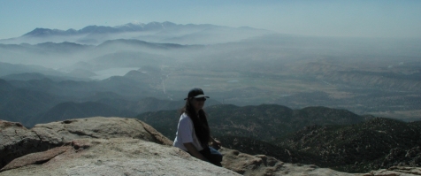
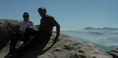
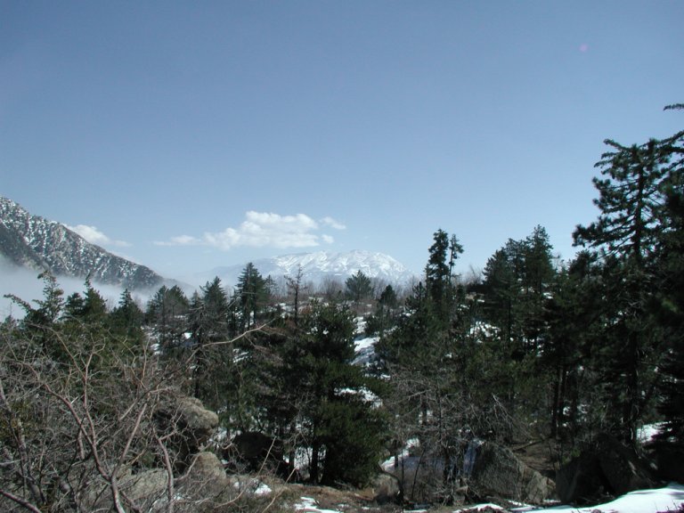
At about this point, we figured we would continue on to the very peak, even though we had not set out to do so on this particular day. We were only about 1/2 a mile from the top. We would reach the peak at 4pm after having set out at 1pm. It was 3.5 miles to the peak with a 1000 ft gain. We arrived at the peak and our breath was taken away with the views. We could see the desert, the mountains, the snow, Silverwood Lake, Strawberry Peak fire lookout, and so on. We watched butterflies chasing each other up in the sky. Lady bugs were every where. It was so pretty there.
It was getting late and I was worried about running into rattlesnakes on the trail. The day was getting cooler and dimmer. So we rested only about 30 minutes before heading on back down. We saw no snakes btw. The return 3.5 miles took us about 90 minutes. Half the time it took to get up.
We promised each other to return soon. Which we did on June 13th with some friends.
There will be a story behind this picture soon:
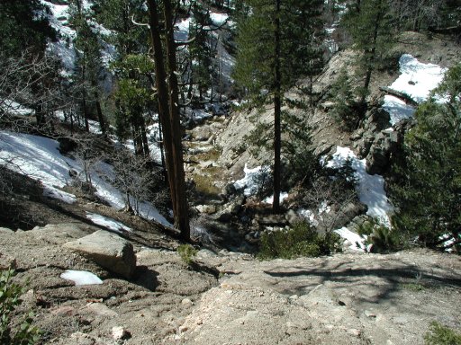
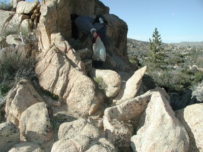
We've been hiking around the past few weeks. During the past week we have been going out every day. We have found some really neat spots. In particular one has been very neat. It starts off by the road, you walk along and come across several abandoned horse corrals. But they look in good shape. So maybe they aren't abandoned after all. Anyway, cross a small creek and follow a road. Then after about 3/4 mi you come to rise, a small dip and WOW! A nice big open area. Creek running through. And a big hunk of white quartz. Totally out of place. Just sitting there. You can tell lots and lots of people have been breaking that quartz down over the years. Probably looking for gold. But there isn't any. How do I know? It's broken down to probably 1/4 the original size, and it's still there haha.
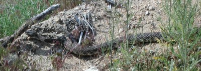
We started seeing a lot of rattlesnakes the day before yesterday. It looks like they are coming out of hibernation. I did some reading about them. They have winter and summer homes. And their winter homes are with other snakes. In cold areas a winter den can have HUNDREDS of snakes. Warmer areas, DOZENS. I don't know but the mere thought of finding a snake den sends me into a panic. It's scary enough seeing one or two. Anyway, Sean and Leo almost landed on top of one while jumping on a rock. It was coming down while they were going up.
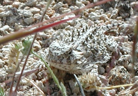
In the same area we have also seen several Horned Toads. Now those are pretty cool looking things. They run fast and it's really hard to see them. My friend said she used to keep them as pets. They're really cute.
We saw a bear at Rock Camp yesterday. It heard us and started up a hill. Sean first saw it and then I did. I don't think the dogs did although maybe Leo could smell it.
I'm pretty well spooked about hiking now due to the snakes. We'll see how the next week goes. They should have finished their migration by then. And hopefully they'll have a few meals in the meantime and not be so ornery.
Toad!
Western Diamondback Rattlesnake
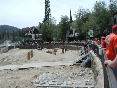
I forgot to mention this! On Saturday the 30th of April, the Forest Department had a big shindig for 100 years of service. It was held at the Lake Arrowhead Village. I had a blast walking around, taking pictures, meeting people and!!! Becoming officially a volunteer for the service! I am a photographer for them *giggle*. This is so cool. So now when we go out and about (like Splinter's Cabin) I will pass along my photos to be used to promote our mountains. Sean and I will also take event photos (like the 100 Years thing) when they come up. We made lots of interesting contacts. Too much to mention, really. I'm excited about this new avenue in my life.
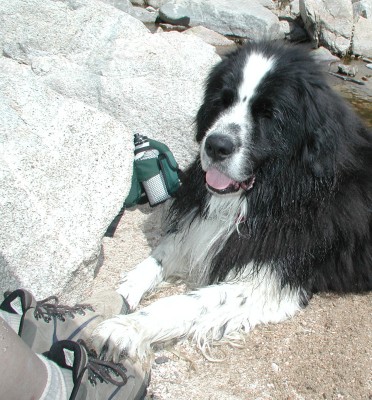
Continuing with the Splinter's Cabin hike . . .
We stopped at just about 11:30 am at the cabin and had lunch. The dogs were running amok and having fun. I was having foibles about getting my feet/boots wet. (there's a creek crossing) Lunch was very nice though. And we found out bugs don't like orange oil ha.
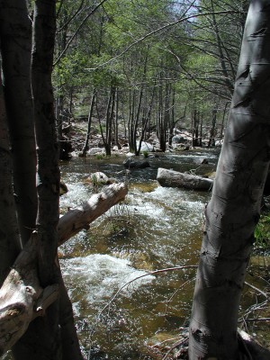
Deep Creek. Hook Creek meets up with this creek to create a larger river.
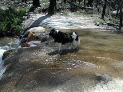
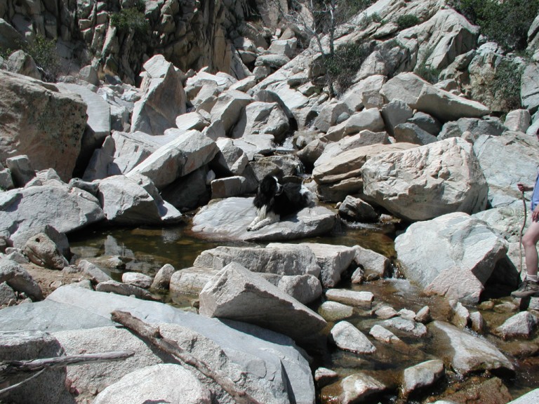
Solo cooling his heels in Hook Creek where it crosses the road. This is where I had mini-heartattacks and refused to get my boots wet :rolleyes:
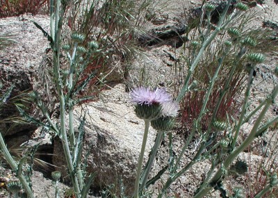
Thistles. Please. Say it out loud with me. With a lisp. Thistles! Tickles, doesn't it?
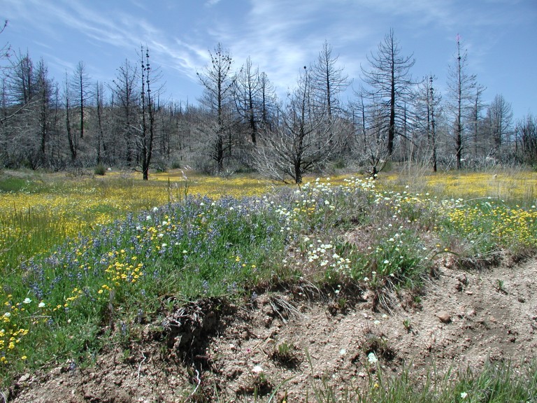
Sorry so big. But it's beautiful. *sigh* Wildflowers growing alongside 3N34.
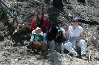
Taking a break. It was getting warm. And I was hungry!
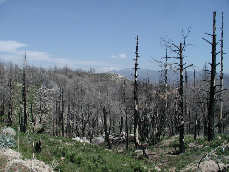
One last look. Again, sorry so big. But it deserved the size. Isn't it beautiful?
We had a lot of fun on this hike. We left the trailhead at 8am and made pretty good time. The creeks were flowing and we could hear bullfrogs. There were plants growing like crazy. We decided we'll need to come back in June when all these plants are flowering.
Some pictures:
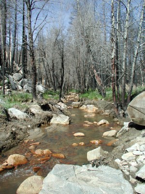
The Creek we hiked alongside.
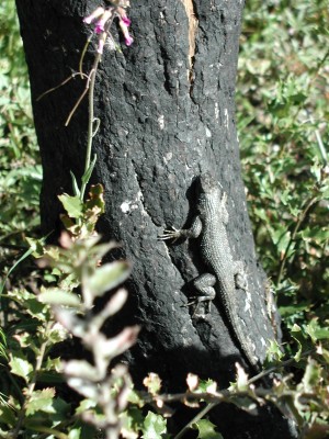
We found this lizard sunning itself on a burned tree.
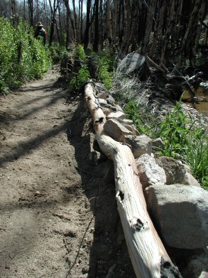
The group who maintains this trail does a lovely job.
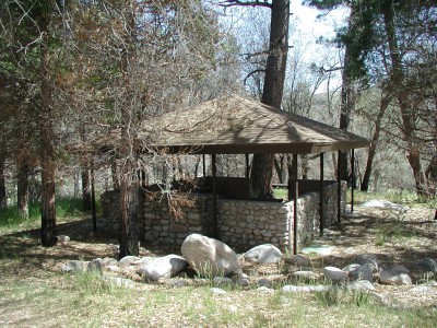
Yay! We made it! *The* cabin.
More tomorrow with pics of the surrounding area.
Rehiking this one! 3W12 from the North Shore Campground to the cabin. Then back up via 3N34, 2N25. Whee!!
~6 miles, leaving 8am. Returning 2pm.
The Map. I found one I thought would be useful. The "yellow" dots are hikes we have done. I will be more specific later but here it is for now. It's BIG
I'm going to see about finding a map to put up of all these different areas.
We finally found our way over to Kinley Creek Falls. To get there:
Hwy 173, past the shooting range. Park at the bridge. Cross the road, follow the path along until just past the "Unburned Acre" sign on the path. Go down to the water then follow up river until you can't go any further.
Solo and Leo came along as usual. Leo had no problems jumping from rock to rock. Poor Solo is just not designed for this kind of thing. But he tries really really hard and keeps up - even when I'm yelling at him to "STOP SHAKING WATER ALL OVER ME!!" heh.
The falls themselves will soon dry up so I'm glad we came when we did. The bottom of the falls there is a deep pocket of water. I'll bet you could even swim around in it - but I wouldn't.

Lil Billy Goat Leo
Solo was tired.
He was holding me in place by putting his paw FIRMLY on my foot lol
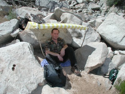
We made a shelter from the sun. It was hot!
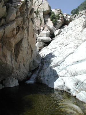
Here are the falls.
Above the falls there is a boulder that looks like an eagle. Very cool.
On our way back, Solo rested for a bit while we reoriented ourselves.
Some day I will be able to take a focused picture of flowers rather than the dirt below them! HA!
It was really rocky. This was where Solo waited while we scrabbled up to the falls.
Me! I got a bit sunburned on those lily white arms lol
We went to see the wildflowers when Mom and Jesse came up. Here's a pic of the view from the rocks we sat on.

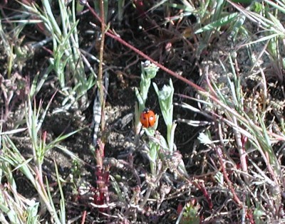
And I found a Lady Bug :)
I'm going on memory as we did this hike about two weeks ago. I don't remember what time we started, but it was morning. When we arrived at the trailhead, there was one car parked there already so we put the dogs on leash for the entire hike. Also, it was windy and chilly. We didn't see anyone until we actually got to the hotsprings though.
The trail is 2.5 miles going up and down along the Bradford Ridge Path. It's fairly well maintained. Narrow and steep for the most part. It's not a hike I would recommend to the casual walker though. By the end, both Solo and I were dragging along. I'm still nursing a bruised toe from this hike.
Picking up from the last time we took this trail:
This view shows where we would be headed. Where you see all the yellow flowers on the furthest mountain would be our destination.
We found a number of wildflowers and I tried to get pictures of them. Here they are. I'm trying to get their names.
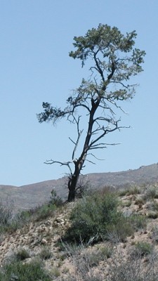
About half way along the path, we passed the Lone Pine. I don't know the real name of the tree. But it stands out as it is the only one around. Also, nearby there's a cache :)
And MORE wildflowers:
Forks in the road can be dangerous places. Taking the wrong one can lead you out of your way and into more difficult trails. Of course, we went the hard way :D Solo had a really hard time. It was slippery with sand and rocks. And very steep. We basically had to get in front of him and brace him as he came down. Of course, Billy Goat Leo had no trouble at all. Unfortunately for all of us, he was on leash and pulled me off balance a few times. We would take the easier but slightly longer trail BACK. heh.
(Go UP this trail, not to the right)
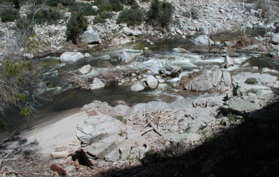
By the time we hooked back up with the trail (about 1/4 mile) we were finally at Deep Creek. We stopped at this beach area for an hour to rest and lunch. Just beyond us, to the right / up river, is the place of the hot springs. It was busy that day with about a dozen or so nekkid people. We left them to their nekkidness while we four splashed in the creek. It was running pretty hard and chilly. Solo and Leo just LOVED the water. But we had to leave them on leash for a couple reasons. We were close to the path and people were using it (the dogs would have run up and bothered the passer-byers) and the creek was running so swift I was afraid they'd get knocked off their feet and swept away. It was hard for even me to stand upright in the water.
We didn't get many pictures on the return trip. We were more concerned with getting back as it was getting late. Solo was having a tough go of it at the end too. Plus my toes were getting hammered. I have a bruised toenail now from that return trip. It was hard and long but well worth the hike.
Round trip ~5 miles. Six hour round trip hike.
More on this tomorrow!!
Not far from home we go to walk the dogs. It's close to the desert and the wildflowers are blooming like mad!! Here's a taste of one day's short hour long walk.
Solo coming down a hillside in a spring wash.

Billy Goat Leo!
Wildflowers. Lovely.
The hills are alive with Solo's!!
Me, Solo and Leo. Look closely for Leo. He will "swim" in front of us when we hike. Solo almost always stays just behind me. DH took the pictures.
Finally Leo gets a bit tired and approaches us.
Solo AND Leo are in this pic. Look closely.
Solo is wondering what's going on behind him.
Fun time is over. Time to go back to the truck. Me and TWO dogs. Look closely for Leo.
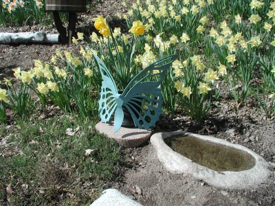
I realized that I wasn't clear about the passage about the garden yesterday. It's from a book called The Daffodil Principle.
Just after I had put that up on the site I received email that the garden would be closed to the public for the season on Sunday the 10th. So Sean and I ran over to see the garden and take pictures.
Wow. That's all I can say from my first impression. Wow. We entered under an archway with trees blocking our view on the left. We got to the end of the row of trees, turned the corner and were faced with a million bright yellow and white faces. Wow.
Pictures!!!

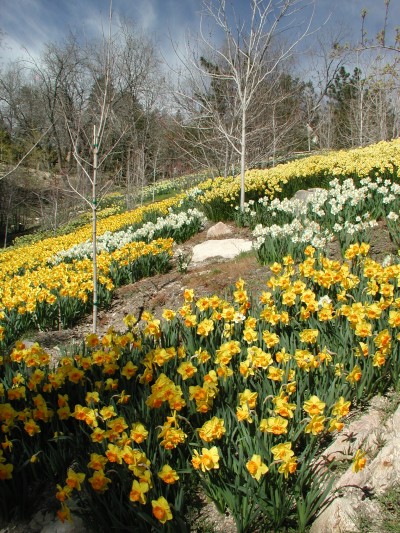
Here is just a little more. It's more current. There are waaaay more than 50,000 bulbs now:
...one million daffodils, accented by assorted other bulbs such as fritillarias, hyacinths, muscari, and tulips. Some of the flowers are in drifts that spill down the steep slopes; others stand in large beds. All were planted, one at a time, by one woman -- Gene Bauer. She started 38 years ago, inspired by a few daffodils in a neighbor's garden. Bauer planted 48 daffodils in the fall of 1958. Needless to say, they thrived. Since then she's planted more daffodils each fall, but in the thousands. Some years, Bauer plants as few as 8,000 bulbs. In the fall of 1993, she planted 35,000. It's a kind of gardening zeal that makes the spring bulb ambitions of most of us seem rather paltry.
Every slope cleared, every trail carved out of the hillside, every bulb planted -- all the hard work -- has been done by Gene and her husband, Dale, but mostly by Gene. Or as she puts it, "The work is done by two hands, two feet and a body minus a brain."
This is based on what one woman locally did to beautify her home. She lives in Smiley Park. I have been waiting to put this up for when I have a photo of the daffodils, but I'm afraid I'll miss their peak this year.
~~~~~~~~~~~~~~~~~~~~~~~~~~~~~~~~~~~~~~~~~~~~~~~~~~~~
........ You will never forgive yourself if you miss this experience." After about twenty minutes, we turned onto a small gravel road and I saw a small church. On the far side of the church, I saw a hand lettered sign that read, "Daffodil Garden."
We got out of the car and each took a child's hand, and I followed Carolyn down the path. Then, we turned a corner of the path, and I looked up and gasped. Before me lay the most glorious sight. It looked as though someone had taken a great vat of gold and poured it down over the mountain peak and slopes. The flowers were planted in majestic, swirling patterns great ribbons and swaths of deep orange, white, lemon yellow, salmon pink, saffron, and butter yellow. Each different coloured variety was planted as a group so that it swirled and flowed like its own river with its own unique hue.
There were five acres of flowers. "But who has done this?" I asked Carolyn. "It's just one woman," Carolyn answered. "She lives on the property. That's her home." Carolyn pointed to a well kept A frame house that looked small and modest in the midst of all that glory. We walked up to the house. On the patio, we saw a poster. "Answers to the Questions I Know You Are Asking" was the headline.
The first answer was a simple one. "50,000 bulbs," it read. The second answer was, "One at a time, by one woman. Two hands, two feet, and very little brain." The third answer was, "Began in 1958."
There it was, The Daffodil Principle. For me, that moment was a life changing experience.
I thought of this woman whom I had never met, who, more than forty years before, had begun one bulb at a time-to bring her vision of beauty and joy to an obscure mountain top. Still, just planting one bulb at a time, year after year, had changed the world. This unknown woman had forever changed the world in which she lived. She had created something of ineffable (indescribable) magnificence, beauty, and inspiration.
The principle her daffodil garden taught is one of the greatest principles of celebration. That is, learning to move toward our goals and desires one step at a time - often just one baby step at a time - and learning to love the doing, learning to use the accumulation of time. When we multiply tiny pieces of time with small increments of daily effort, we too will find we can accomplish magnificent things.......
"It makes me sad in a way," I admitted to Carolyn. "What might I have accomplished if I had thought of a wonderful goal thirty-five or forty years ago and had worked away at it 'one bulb at a time' through all those years. Just think what I might have been able to achieve!" My daughter summed up the message of the day in her usual direct way. "Start tomorrow," she said.
It's so pointless to think of the lost hours of yesterdays. The way to make learning a lesson of celebration instead of a cause for regret is to only ask, "How can I put this to use today?" . . . . .

I will have a trip report on this tomorrow. I think. Ha ha. We hiked here yesterday. Six hours - five miles. What a hike. I think Solo will not want to go with us any more lol
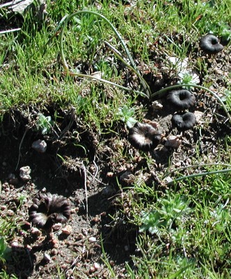
Mushrooms found near Kinley Creek
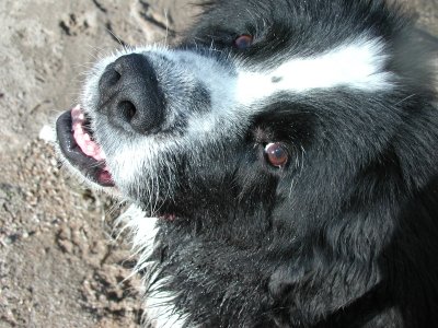
Pretty face :kisses:
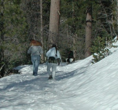
We hiked to Mill Peak with the dogs and some friends this weekend. Sometimes though, I really need to pay attention to signs and get a clue!
What can you tell about this picture that should have raised multiple red flags??
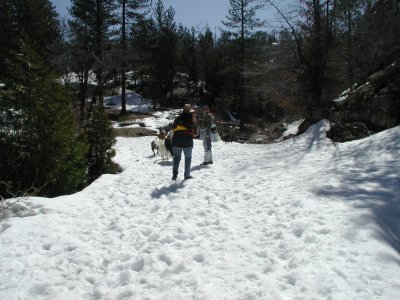
Why yes! It must be that! SNOW. :|
Note to self: When hiking in snow, wear snow boots. And bring extra socks. Lots of them. And plastic bags for your feet. Lots of them. Not lots of feet, lots of bags.
Sheesh. What was I thinking? I was thinking, HIKE! Let's get to the top! ha I will only mention this once and here. All our feet were soaked. Our boots were soaked. And I'm sure I wasn't the only one with cold feet. At least none of us got frostbite!
We hiked up the 1/2 mile to Dry Creek, which is flowing very nicely! It wasn't a difficult crossing. But Brandy (doggie) needed a bit of help and lots of encouragement.
Just after the crossing, (and finding the path covered with a couple feet of snow) we climbed upwards and got a great view of Dry Creek from above:
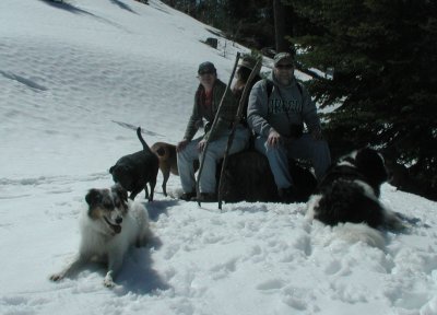
Solo was having a great time. He was very much in his element with the snow and cool temperatures.

And onward and upward we went until we reached one of the viewing spots. It was a bit foggy below but we were able to see the mountains to our left.
And we rested a bit before tackling the last 1/4 mile. Leo easily ran 2x what we walked. So he needed to sit a spell ;)
Yay!! We finally made it! And this was the best shot we got lol.
We had lunch and rested while our shoes and socks dried a bit. Then I looked around to try to find the Peak log book that seemed to have disappeared. I found it scattered all over and put it back together as best I could. We signed it, tucked it safely back in its hole and set off back down the mountain.
With only about 3/4 mile left, Solo and Leo were taking advantage of every rest point. Well, Solo right away. Leo would run around scouting the area and checking things out. Then when satisfied, he'd take his spot next to Solo to rest. Silly boy :)
Poor Brandy had to have a bit of help toward the end due to sore (cold?) feet. She got a lift from her friend, Steve (did I mention all the snow yet??)
When we finally reached near the cars/trailhead, the fog had rolled in. I swore to never call a hike "Easy" again, we said our goodbyes and we agreed to do it again soon ;)
4 miles round trip.
|
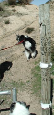
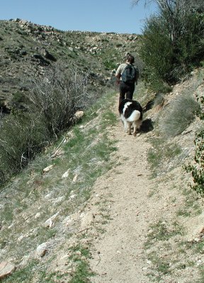
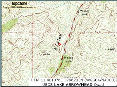
I have no idea who Bradford is, but this is a pretty cool hike. It's back by the Pinnacles, just next to the bridge. Take the path next to the gate and go down the wash.
The creek is part of the Kinley Creek... creek. (whatever) And will eventually become a waterfall. This creek will dry up sometime toward the mid-summer (I think). It leads to Deep Creek, down in the desert. I'm really not sure how long of a hike it is as we only followed it for about a mile before turning back.
|
The path itself is fairly narrow and climbs steeply at first.
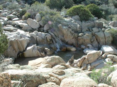
We could see the falls from the path. And not long afterwards we were able to access the creek. The dogs loved playing in the water here and there were a couple of very nice shady areas plus sandy beach areas. I can see this being a very popular picnic area!

Further along the path you will see this sign:
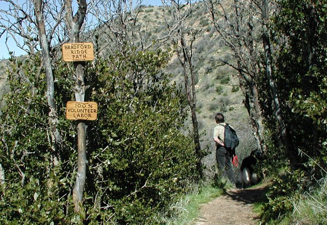
It's beautifully framed by trees on either side of the path.
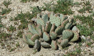
The neat thing is how many areas we passed through. From the forest to cactus. Neat! This was our turn around spot. It sat high above the creek canyon and was a bit windy. It must be the natural high spot of the area.
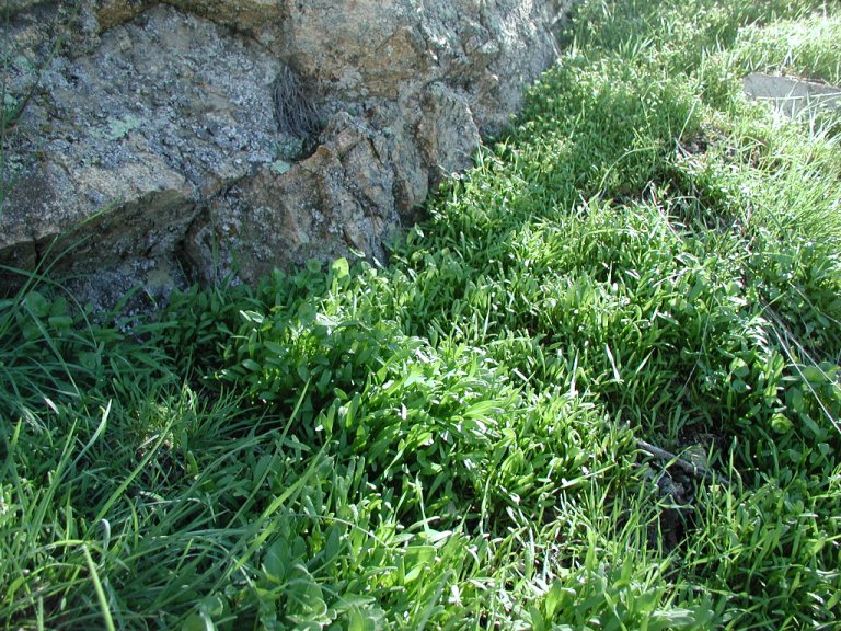
This lush green grass made me want to be a little fairy lol
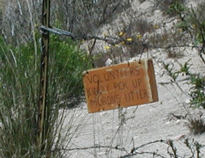
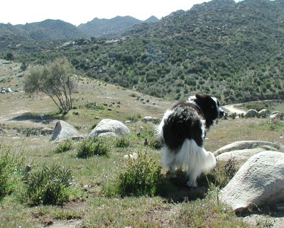
Here is where we hike a lot. The creek is named Kinley Creek and it flows down from the Pinnacles. We have never seen anyone here but we can clearly hear gun fire from the nearby shooting range (Private).
When we first started hiking this area last year, I was concerned someone might be out shooting where we walked. We find tons of spent shot gun casings around. But we haven't seen anyone at all. We figure people must come there at night or early morning. You can tell people have been there from all the trash.
Yesterday we decided to follow the creek down a bit to see what we would find.
We found a bunch of interesting rock formations in the area. I'd sooner expect to see something like this in Joshua Tree NP. But as you can see from the roughness, this rock is not as ancient as the Joshua Tree NP rocks.
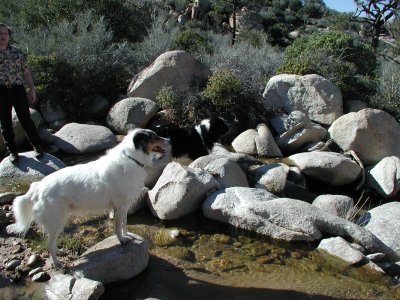
Kinley Creek has a lot of falls when there is water. Come fall, it should be dry. But now, we have lots of water to play in. The dogs love it

There is so much trash in the area that I tried to help remove some. I can't tell how many bags we've taken out in the past year. There's always a bit more though!
Solo waited for me to finish collecting garbage lol
And the family shot:

If Solo were a black or a brown Newfoundland, I would seriously worry about some newbie shooting him in the mistake he was a bear. We often hear comments on that effect. And I have mistaken bears for Newfoundlands in the past. No joke
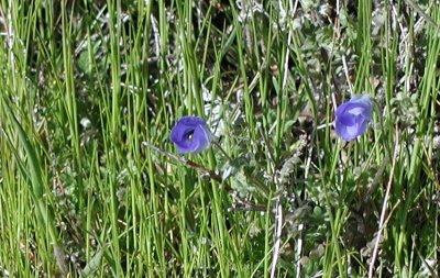
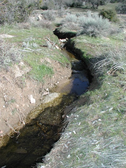
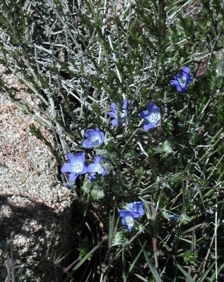
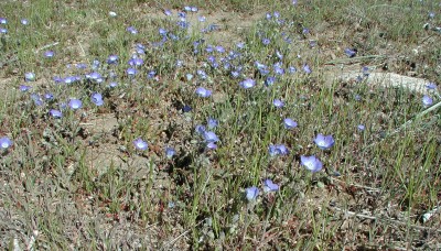
Spring ~ has it sprung??? We took a short walk on Sunday along a seasonal creek with the dogs. It was a walk to remember Khiori. The ground was very wet. Soggy. The river was flowing pretty good and we had to go around in places in order to cross.
Mosses and new grasses are starting to grow. And wildflowers are just now starting to appear. They are small and blue.
Later we will get yellows. Then orange flowers.
By and by we will get back over to Holcomb Valley to see what grows there.
I love spring. Everything is new again.
It's a gorgeous day though. It's warm and sunny.
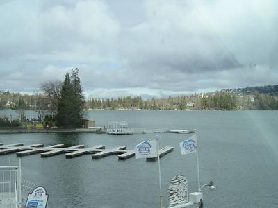
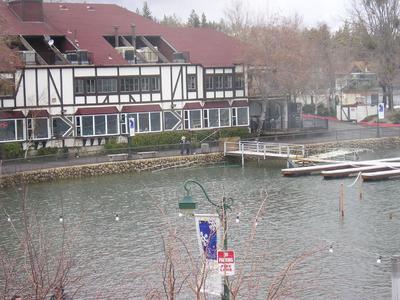
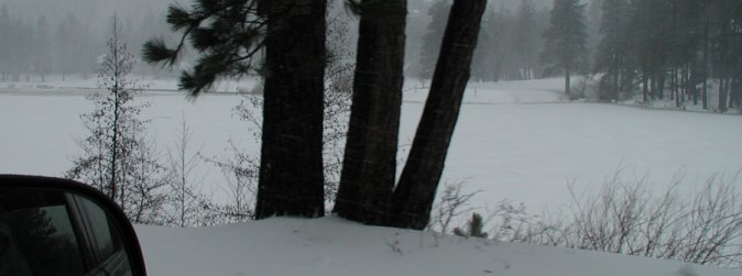
Here are some pictures of Lake Arrowhead last year before we got all these rains. What a difference!!
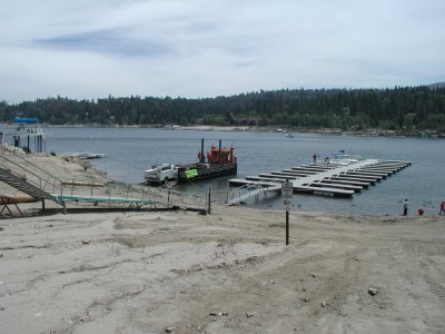
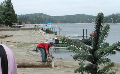
Yay! The lake is full. These were taken last week by a friend. We haven't been by the lake yet. They've opened the flood gates. Lake level 5106.something. YAY!
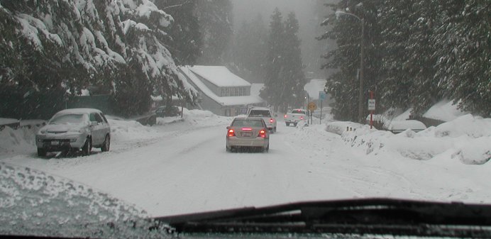
The sun is finally coming out. It appeared yesterday :) All the roads off the mountain were closed for two days. But it gave some time for clean up.
They are slowly reopening. Some (like 18 to Lucerne Valley) will be closed for some time. And the mail will finally be coming in, like groceries to the stores.
Arrowhead now has recorded 65" of rain for the season. I don't know what the storm total was. But I was watching from when it was 40" to 65".
Lake Arrowhead is about 5 feet below full. YAY!!!
The dam is overflowing and what a lot of rain!!
I think the lake is full for the time being:
Overflow from the dam:
Know before you go! Everything is going fast.
Wow. We're getting about 1/2 inch of rain an hour.
Lake Arrowhead Weather Station
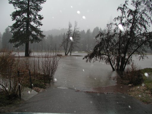
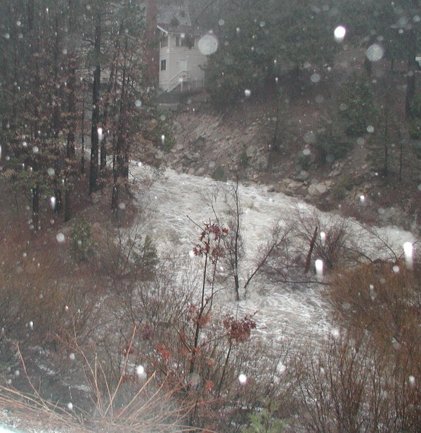
Wow. This is one heck of a storm. Yesterday about 100 cars got stranded between Snow Valley and Big Bear Dam. Today, I'm hearing that Valley of Enchantment's mobile home park is being washed away. And *everywhere* I keep hearing the worst is yet to come. Tonight the snow level is supposed to drop to 4,000 ft (about 1300 ft lower than us)
Friend's are being flooded in their homes. One's basement, another has water seeping up her bottom floor. Luckily we haven't had a single drop come inside. Quite amusing since the two leaks I *know* of aren't leaking. I figure they've been healed ;) (wood swelled?) One dog doesn't want to come inside (Solo) and the other doesn't want to go out (Leo). And drum drum drum on the roof goes the rain.
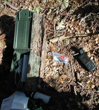
I have been able to find a couple neat things though. Sean wrote me a program to have up-to-date weather alerts. And I have found a little something else for weather. Plus there is a local scanner online.
We're pretty well hunkered down with plenty food and everything buttoned up around. Everything outside (including vehicles) have been brought in (actually months ago). Water is all flowing away from the house not INTO it. (yikes) I'm going stir crazy wanting to be out in it HA.
I'm waiting to watch my favorite program on tv this evening : Extreme Makeover Home Edition :D
Of Biblical proportions? It's amazing! 20" of precipitation due over several days. It started to snow early Friday. And wouldn't you know it we HAD to get to town to mail a package. So off we went!
Grass Valley Lake. It had frozen the day before. Then it snowed on top. Neat effect!
The road through Agua Fria on our way to Blue Jay.
I'm not sure if this is "personal" or "local mountains" related. But it *is* an observation of mine. And I am a bit saddened over it.
It seems like people have become so bitter and angry lately. I'm quite saddened by it. I love these mountains and communities. That being said, it feels like as soon as you get one bitter minded person in the mix, the whole place goes to hell in complaining and whining.
I am finding that I am happier putting these discussions out of my line of sight. At least for while. Maybe it's just cabin fever on their part? Maybe people really are mean spirited. Who's to say? I just know I don't want to become like that. I tend to mimic what's around me, so leaving 'pity parties' are my best path.
It's so sad though. People come here because of the way it is. Then the first thing they want to do is change it. And bitch about what they already knew. YES. IT SNOWS HERE. And all the rest. Bah. I'm getting bitter. I'm going for a walk.
Here are some pictures from the Splinter's Cabin hike. It was a very nice hike. I'm thinking of doing it again once the weather turns warm. Probably springtime. When the wild iris are in bloom.
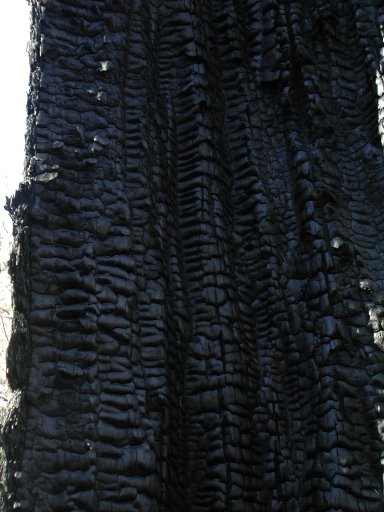
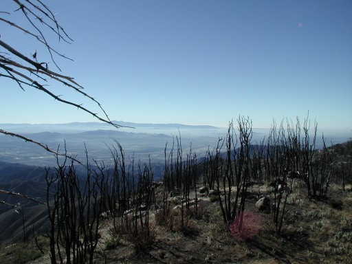
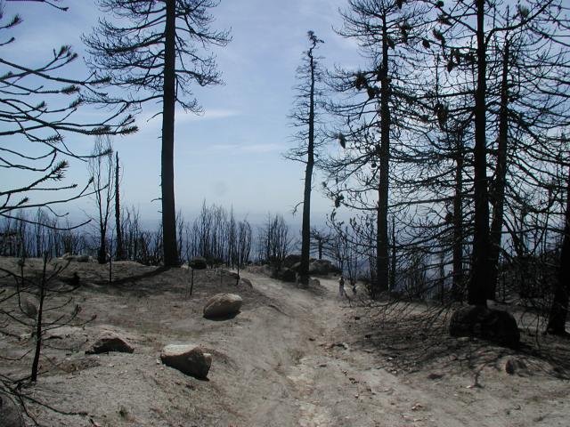
Burned out tree on the Pacific Crest Trail.
Moon rising between trees.
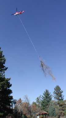
Ok, going to try to get this one today. It's really windy out and cold. Hopefully the gate to the helipad will be open so we don't have to walk up the whole way. In fact, if the gate is closed - we'll skip it. There's no place to put the car without fear of getting towed away ha. :erm:
*note added 2006 May 07 - This was for a geocache
Well, here are a couple pictures taken along the way:
We hiked to Splinter's Cabin this weekend. We started off at the Northshore Campground and walked the road to 3N34C (Splinter's Cabin). I will write more about this tomorrow and have some pictures too. Wouldn't you know though? We didn't get any pictures while at Splinter's Cabin. But everywhere along the way we did!
Take Keller Peak road for 1/2 mile. Look for the big turn out on the right. Go around the closed gate. Follow that road until the first fork. Go left. Follow the road until you see a road go off on the right. Take that!
Look for the ribbons and follow those. At close to the top, you will see two ducks on the right and ribbons going up that way. That's the way you go. If you are like us, OTOH, you'll miss this and keep following the road :D If you go this way, once you get to the "front side", look for the trail heading up behind you. Follow that. On top of some boulders you will find a can to register your hike :) Mill Peak!
Round trip from Highway 18, Mill Peak and back is ~4 miles or so.
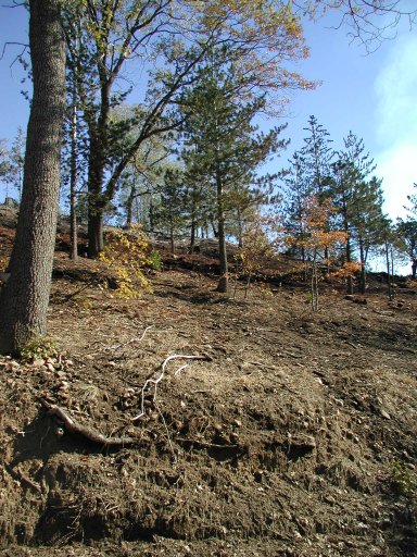
Here are some pictures of the control burn that took place over at Tunnel Two on Saturday, October 31st.
They were very careful!
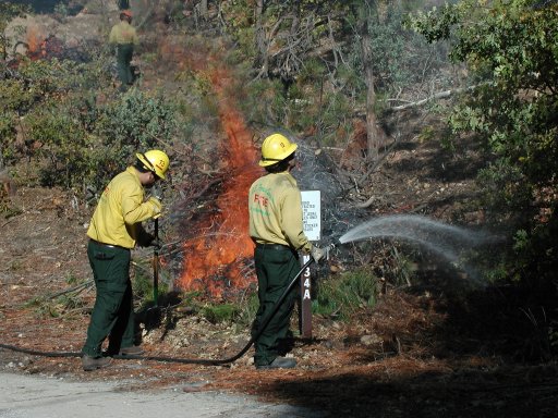
This is how they would burn a pile of branches and things. I think it's called "Slash"
Later it would burn down to just about nothing.
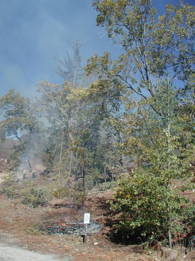
The end result is to be a "parklike" setting. This area was not far from where they were working. It was finished and the birds were already there singing away.
Here is a picture of some of the trucks we saw. Most were not this kind but the fire engine type.
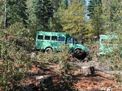
Saturday we got to watch the Forestry dept. guys do a control burn near our house. It was very interesting to see how they do it and how it would look when done. Tomorrow I will post some pictures of the control burn and what the land looks like once it's completed.
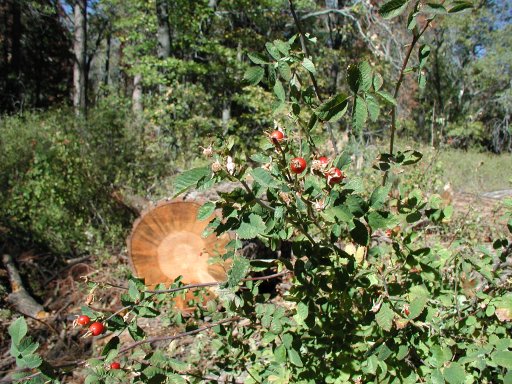
I guess Monday's are good for the weekend trip reports lol. We went geocaching locally on Saturday and Sunday. We only found two on Saturday. One was back near Willow Creek Falls. Just along the trail there 3W12. We walked a good 3/5 mile before getting close to the cache. Then just a bit off the path to find the actual box. Just above us there was a road with people walking with their dog. Made me go "hmmmm" :\ thinking there was probably a much easier way to get there.
We walked past a nice big patch of wild roses covered in rose hips.
We next drove around the lake and stopped at the hospital for a cache that's hidden in the parking lot. It was a quick in-and-out cache. There's lots of activity going on behind the hospital. Now with the rains the dust has settled. I'm sure that's a big relief to the hospital. Come to think of it, I applied for several jobs there and never heard back from them :mad:
Sunday, we had plans to meet friends at Lake Arrowhead for breakfast at Belgium Waffle Works. I don't know why we all keep going there lol. The wait is super long, we all have waffles but I think we're not that crazy over waffles. But it's a nice place to eat. Maybe next time we will go back to Crestline Top Town to Loose Caboose :)
Anyway, I digress. We had breakfast and finally said our good byes at noon. They are planning on moving sometime in the future - even though we don't get together often, Sean and I will really miss them :(
So we hit the trail for some geocaching. I had no idea how many we would hit because it's so easy to hit snags. And sure enough, we hit one right off. First cache was a multi cache. So go find clue and alter the final coordinates to find the actual cache. Problem was we made the adjustment on the last coordinates and went hunting. Nothing.
Put last coordinates back to default and changed the first ones. Nothing. Finally made changes to both and found the cache. That took a good hour and a half and probably 2 1/2 miles of tromping through mud and forest. Dropped off a travel bug.
There was another cache nearby. "Only" a third mile. Insert that very aggravating "rolleyes" smilie here. :| Another hour later and 1 1/2 mile tromp through mud and forest and we finally found the cache. TNLNSL. Off we went.
There was another cache close by off to our north west so we drove over there. 2N75 I believe was the trail. Anyway, it was a quick one. In and ... not quite out. I noticed a cache nearby again. "Only" 1/3 mile away. The GPS was pointing us to a trail clear as day. So we took it. The last tenth of a mile is always the worst. It was straight up a ravine through - you guessed, mud and forest. We read the directions and decided to approach from another direction. One that was to take us within 300 ft from car to cache.
It was an awesome view up there. If it had been clearer we could have seen forever. Anyway, once there, again it was a quick find.
We were going to try for one last cache. One that I have been attempting since we started caching. You park at the Pinnacles Staging area and hike shortly to the cache. Problem is that the road leading to the cache is closed due to fire danger. You can hike in, but you can't drive it. According to the GPS from the road it is 3/4 mile to the cache. That doesn't take into account all the winding the road does. We got over there with the intention of hiking in but there were three cars parked there (since the day before). We figured they are hunting and didn't want to disturb anything going on. So we skipped it yet again for another day.
And lovely for me - woke up with a cold. It feels like one that comes on quickly and leaves just as easily.
It's raining. A LOT. It's been raining since Sunday and I believe the area has gotten about 12" since it started. Yikes. And not even El Nino this year.
The whole forest is dripping and soggy. The birds are out singing now - even though we're socked in with fog. Most of the roads have some kind of damage or closure right now. And it's still raining!
Here's my Halloween decoration. Seems like something near tragic happens to me/my family around this time of year. Let's go low profile. There's my pumpkin (look left - on main page)
Just a quick note. The Children's Forest Presentation is up. I will add text later but I wanted to put the links all up. Check it out: Children's Forest
Windy!!! It's getting windy but warming up again. The Santa Ana's are here!!! Don't get blown away!!! (all the !!!'s because it's windy ;) )
Got to help put the fence up at Mill Peak and meet lots of nice people. Then went over to the geocaching potluck - got to meet more nice people and had a lot of fun. :) Was a long, busy day but well worth it.
Tomorrow is a big day for me. An interview *gasp*
It's here!! Two cases of west nile virus up here in the mountains. One for sure, one suspected. Gotta keep on top of those puddles and such! I'm going to double check that our fountain is dry and all my watering barrels are secure. Mosquitos. Nasty buggars. They'll bring heart worm to my dogs too. Not to mention the Asian mosquito (also called the Flying Tigers!) are now in Orange county. Those are blamed for yellow and dengue fevers. Lovely.
I had a really nice slideshow almost done to put on the site. However, it was HUGE! I'm going to have to do it over and much smaller. I hope it will be finished and uploaded soon.
This weekend is a fence rebuilding project. Sounds like a lot of fun!! I called and signed up today to help out. A couple friends did the same - so I'll know some folks. I'll bring a camera. This is the place we went for Sean's birthday this year with the dogs. I can't wait to see the place again :glee:
Here's a picture from March. You can see me and the dogs along the path (very small looking). The trees there are/were huge! The wind was coming through a little and it was so weird to hear the trees creaking like charcoal. Ready to crumble. I hope it's starting to grow a bit again.
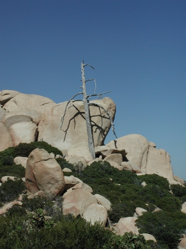
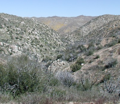
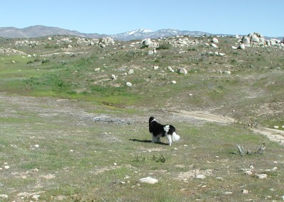
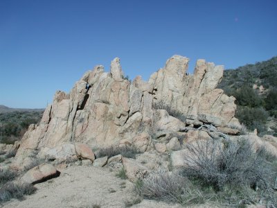
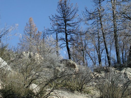
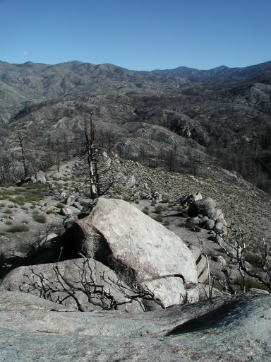
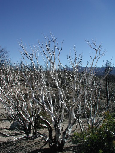
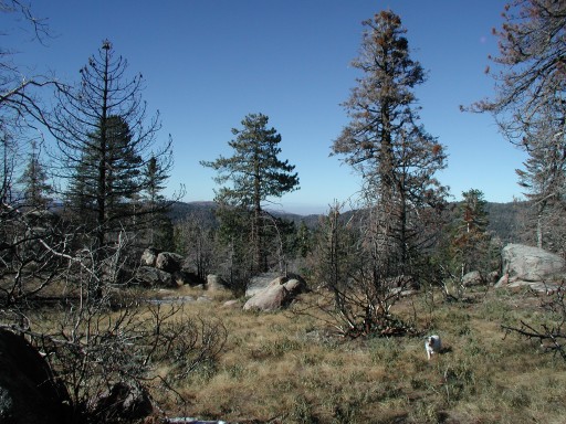
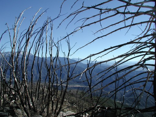
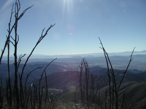
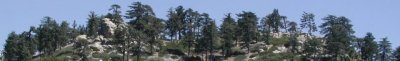
I guess this week is picture week :o This is the Pinnacles. I'm fairly certain that most, if not all, of those dead trees have been removed now. It's such a rugged place. I enjoy the distance views, the magic of the place and the quietness. That says a lot when the mountains are fairly quiet anyway :)
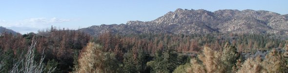
I love this place. It has such amazing views.
This trail is rated as easy and is about 1/2 mile on paved walkways. It is near many other hiking trails and notably near Keller Fire Lookout. To get to this area, take highway 18 toward Running Springs (from Lake Arrowhead area). About 1 mile past Running Springs, on the right, you will pass the forest service parking and building. The very next road is the way to go. Turn right and drive drive drive. About 6 miles up, you will meet up with a Y intersection. The right goes on to Keller Peak and the left goes to the Trail of the Phoenix. *Well* worth the trip. Take a picnic and the puppers for a great day.
Another web site concerning the Mountain Communities of the San Bernardino mountains. Thank you for visiting :o)
|